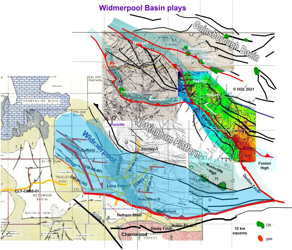
As with Nottingham Platform, seismic in the Widmerpool Basin images NW-oriented, northeast-dipping extensional ramps controlling sedimentary infill. The extensional opening was to NE, whereas the plate tectonic compression shortening the basin at end-Carboniferous was to NNW which means re-activated faults trending NNW became strike-slip in nature.
So seismic lines trending west-east like 86-301, 86-302 and Needwood 85-01 clearly see the large extensional rollover geometries on the big ramps, but they don’t show much of the inversion overprint, inversion faults are more or less bed-parallel in that sampling mode. Northerly-trending lines like 84-14, 83-17, 84-10, 86-107, are the ones which best image the inversion folding and new footwall collapse faults.
A particularly strong ramp is shown shaded on the map, below: the west end of the Widmerpool and satellite Needwood share the same structure style.


