South Humberside instance from the report: this seismic is BP83-71 and its a lot better than it looks!

Humberside
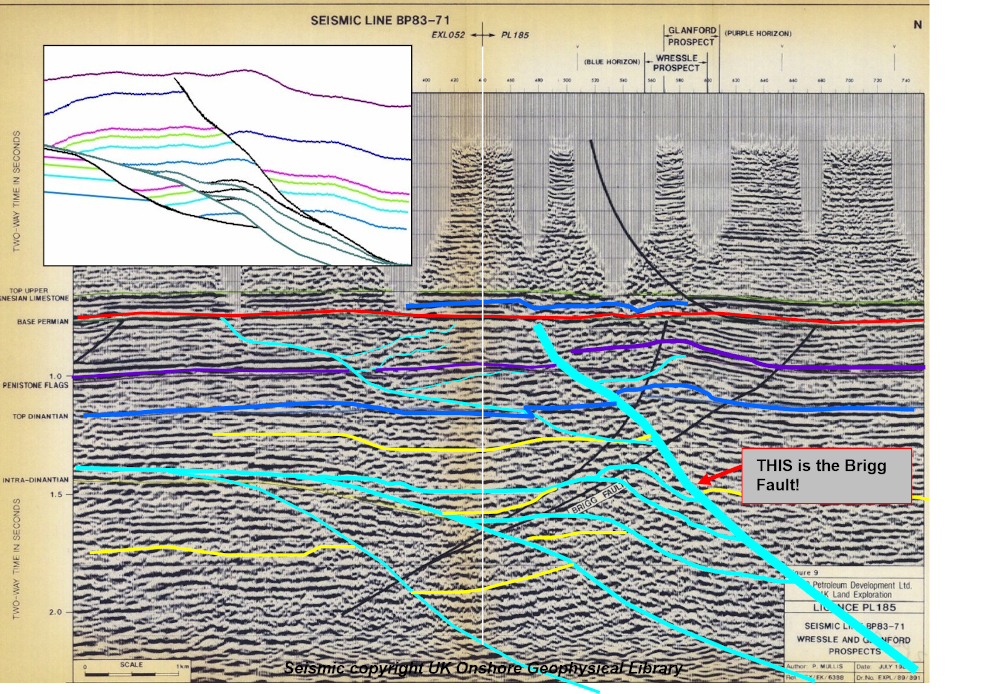
Inset is our footwall collapse model. We don’t agree that the Brigg Fault as drawn in black by BP in the 1980s, and accepted by other authors, dips south. Our faults are drawn in pale blue, the intra-Lower Carboniferous extensional faults dip to NNE and not southwards. Structures like Wressle and Glanford, and Brigg itself, are bounded on their southwest flanks by these NNE extensionals, with an element of reversal (fracturing, too) resulting from Variscan inversion.
This fundamental difference indicates undrilled footwall potential is significant at Brigg.