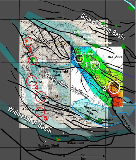
This map shows part of the extensional growth fault ramp system (the green shaded trends) which developed in Tournaisian-Namurian, and is present in all of East Midlands’ basins. The ramps are critically important to prospectivity, they control sequence, extensional rollover structure, and the patterns of inversion. Numbers are exploration centres we discuss, in that area.

East Midlands
Exploration to date has focussed on Variscan inversion structures with Namurian and base Westphalian reservoirs. These are seen readily. Mapping at top of Lower Carboniferous (EC6 in the sequence stratigraphy) identified all of them, and saw them drilled.
On the other hand, extensional growth structures of the Early Carboniferous rift phase have NOT been mapped at the level of detail oil and gas exploration requires to confirm targets reliably. Understand the structural geology of the northern basins, drill more wells, and we’ll make discoveries which for the next 10-20 years will reduce UK’s reliance on imported gas.